


Day 10 Monday, May 27, 2013
1020 Position: Latitude 01 32.4 S, Longitude 148 56.2 W
Speed 14.6, Course 036,
Barometer 1010, Weather: Sunny, partly cloudy, hot
Total miles run: 2819.3
At 10:30 am, we've got 120 miles to go to the Equator! We're also halfway to our first stop in Ensenada, Mexico. It's another classic equatorial day: hot, sunny, almost windless, and the pale blue sky is dotted with cumulus. Flying fish are launching themselves off our bow wave; the sea is turquoise where the sun hits it and blue-green under clouds.
As mentioned before, the container ship that we and Sockdolager are aboard, the M/V Hugo Schulte, is going more slowly than it normally would, in order to save fuel. Chief Engineer Lawrence told us that at normal speeds (22 knots) this voyage would take ten days. But who would want to rush? After all the sailing we've done, being mere passengers with no duties is both weird and pleasureable.
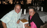
Later, on the Equator: the crossing ceremony was a complete surprise to its intended "victim," and everyone had a good time. Jim and I bought a few bottles of wine for the celebration, and RJ the steward made a huge delicious lemon cake. We toasted the occasion with the crew.
Jim looked magnificent in his Neptune costume complete with tinfoil crown and epaulets, and I felt elegant as Aphrodite in my cape and knotted turk's head jewelry. The entire Russian crew wanted their photos taken with Neptune and Aphrodite, and we obliged. The Captain presented Barbara with an Official Diploma recognizing her ascension from Polliwog to Shellback, Neptune gave a stirring speech in his best stentorian tones, a poem was read, a bit of saltwater was sprinkled over Barbara, and immediately after dinner we all rushed six stories up from the mess hall to the wheelhouse, to witness the actual crossing of the Equator.
"Wait'll you see it," I said, "There's an actual, visible line in the water!"
"There is?" said Barbara.
"Oh yes," said Lawrence. "In fact, if you want, we can dip down with a bucket and take a little piece of the Equator for you. It's so big, nobody'll miss it."
By then Barbara had caught on, but she was a good sport. "I'd like to see what Customs would do with that," she commented drily.
Picture yourself going through Customs, we all pondered aloud. 'What's in the jar?' they'd ask. 'Oh, that's just a piece of the Equator,' we'd say. 'Lady, please step out of the line,' they'd say.
As we crossed the line the First Officer let loose with a big long blast on the ship's horn. Oh, I would love to sound the horn, I said to the Captain, you know, sort of a shave-and-a-haircut-two-bits signal. He replied that if I did that, the crew would be at their muster stations ready to abandon ship. Okay then, bad idea!
Here's the poem we wrote for the occasion:
Neptune's Excellent Equator Crossing Poem
I could not say anything greater
than, "You have just crossed the Equator."
The sea's my domain
And forever I'll reign
with my trident and charts by Mercator.
A Polliwog you are, no longa
Having crossed 'tween Hawaii and Tonga
It's Shellback, you daughter
Of open blue water
From now on you'll be wiser and stronga.
It was a totally excellent day.
Day 11 Tuesday, May 28, 2013
1100 Position: Latitude 02 56.4 N, Longitude 145 18.3 W
Speed 14, Course 046,
Barometer 1010.7, Weather: Sunny, partly cloudy, hot
Total miles run: 3167
Jim likes to stay up late and sleep in, and I'm more of an early bird. The other night he stayed up and watched a movie.
Me: Which one was it?
Jim: Oh, it was one I knew you wouldn't love. It's called 'Earth's Last Day.'
Me: Was it good?
Jim: It was really, really bad.
Me: Tell me about it!
He describes just the beginning, which involves a piece of dark matter falling to earth and going right through some guy's chest. It leaves a big smoking hole and then it burns through the earth and goes out the other side. The holed guy, still alive, is found by onlookers, and he gives them his last words—'Don't forget the circles.'
Me: Whoa. Intense. Yawn.
Jim: I concluded that it's highly doubtful that a guy missing his lungs and heart could speak.
Me: This is your medical training at work. Let me know when you have other deep conclusions like that.
Jim: Happy to help. I'm watching all the bad movies so you don't have to.
At lunch, both the Captain and the Chief Engineer were eager to know what we plan to celebrate next. We brainstormed a list of holidays that occur between now and next week, in the US, Croatia and Romania, but the list is pretty thin. Maybe we should declare International Cake and Ice Cream Day, with RJ as its patron saint.
Today, a tropicbird is following the ship, soaring and swooping overhead. It's bright white but otherwise did not match the description or picture of either the red-tailed or white-tailed species in my identification book; it has a yellowish beak but not the exact same wing markings as a yellow-tailed tropicbird, and its tail plume is yellowish-white.
I watched it for quite awhile. Tropicbirds are so lovely and graceful. The other birds we've seen since leaving NZ and colder waters were a couple of flocks of agile Phoenix petrels having good luck with their fishing. Later: We came upon a flock of tropicbirds; one was sitting in the water before rising and flapping away. I've never seen one land on the water before. Barbara reported that she'd seen a bird that matched the description of a Phoenix petrel, sitting atop the forward crane until it saw something, then diving for it and returning to its perch with a meal of fish. Other than these sightings, we've seen very little bird life. This far out to sea, there is less of it. But the Big Dipper is visible again!
Day 12 Wednesday, May 29, 2013
1315 Position: Latitude 07 58.7 N, Longitude 141 08.8 W
Speed 14.6, Course 039,
Barometer 1008, Weather: Cloudy, squalls, hot
Total miles run: 3559
Maybe it's psychological, but it feels and looks different in the northern hemisphere. Within half a day of crossing the Equator, the cloud cover began to increase until today it's mostly cloudy with occasional squalls. It's the Inter Tropical Convergence Zone again, and this time we get to sleep through every squall and stay warm and dry. The swell is now more markedly northeast, including those long ocean ground swells. Looks like we're near the Northeast Trades.
This has been an idyllic trip so far; the Captain said he's had an easy time of it, but when it gets rough (and it can get very rough because this ship goes year-round) he and the crew must steer around the storms and hang on. In our cabin the chairs have little chains for attaching to the floor, and everything else is attached to something so it doesn't come adrift. Late May is fairly benign in terms of hurricane frequency, but they are possible in the northern hemisphere. However, nothing worrisome shows up on the weather forecast.
Last night in an effort to get a last sighting of the Southern Cross, Jim went up to the bridge deck but stayed outside the wheelhouse, walking the perimeter. He walked past the AB (able-bodied seaman) on watch who was gazing out the wheelhouse window, and without meaning to, gave the poor fellow the fright of his life. Ghosts on ships are not a good thing. The tradition is to announce "on the bridge" whenever you arrive up there, and we will do that from now on.
Today we asked RJ to show us the ship's giant freezers and fridges, and they are indeed huge.
It's ice cream Wednesday! The Captain has instituted this new tradition in our honor, and also because he admits to a fondness for it, and also because there's plenty of it to last until we get to Oakland, hooray!
Wednesday, May 29, 2013
Monday, May 27, 2013
New Zealand to San Francisco, Day 7-9
Day 7 Friday, May 24 2013
1415 Position: Latitude 14 01.9 S, Longitude 159 24.2 W
Speed 14, Course 040,
Barometer 1007.5, Weather Sunny, partly cloudy, hot
Total miles run: 1823
The clocks were turned ahead one hour last night. I'm (K) getting a bit relaxed lately about recording our daily position at exactly noon because, 1) that's lunchtime, and 2) we aren't keeping any watches. But we are about 1/3 of the way through our crossing. And we are definitely back in the ITCZ-style tropics, with hot muggy air, scattered occasional showers and small vertical cumulus clouds. A nice day, with both of us working on various projects in the comfort of our now air-conditioned cabin. Jim assembled some slides of our voyage, and also of home, to show Oleksandr, the Second Officer, who is very curious about it and is himself a good photographer who has been all around Russia taking photos of beautiful landscapes, polar bears, walruses, birds and other wildlife.
A few flying fish and a couple of birds are all the wildlife we've seen. But Oleksandr saw a sailboat today! The Captain later remarked that this looked like a perfect sailing day, and we agreed: in the afternoon the trade wind was about 17 knots from the SE, with 2-3 meter swells and a few whitecaps.
Lots of trips up and down the 5 flights of stairs to the mess hall (add two more flights for the main deck, and another for the bridge) are keeping us at least minimally active, and a few walks around the ship add up, as each circuit is about 1600 feet. So, 3 ½ laps around the ship is about a mile. You can't run or go too fast because of the narrowness of the side deck and the many things to step over, but it's too hot to go fast anyway. Plus there is a surprising amount of swaying in these 2-3 meter swells that requires keeping one's balance. I remember in the Marquesas the exertion of a simple walk up a steep hill; we'd be soaked in sweat, with the incentive for brisk walking gone.
The ship has a small saltwater swimming pool, and our fellow passenger Barbara is having daily swims, but says the water sloshes around a lot. Planning for the Equator crossing ceremony is coming along nicely, and we will have it on Monday at dinner, after we've crossed. We've made up a spiffy trident out of aluminum foil-covered cardboard and a mop handle, a beard for Neptune (from the other end of the mop), a cape for Aphrodite, some foil crowns, two bright orange epaulets made of flattened turk's head knots for Neptune, and some other stuff. We also made up a special Equator Crossing Diploma with signature lines for the Captain, Neptune, and Aphrodite. Printing it out in color and laminating it took the combined chuckling efforts of the Captain, Chief Engineer and Third Officer. The cook is going to bake a cake, our steward is going to be the "photographer," and the whole crew is enjoying being in on the secret. We'll let you know how it goes.
Day 8 Saturday, May 54 2013
1300 Position: Latitude 09 57.5 S, Longitude 155 53.4 W
Speed 14.7, Course 040,
Barometer 1008, Weather Sunny, partly cloudy, hot
Total miles run: 2163
A classic sunrise this morning, with more vertical cumulus and those delicate tropical colors highlighting the clouds. The sea is so magnificent! A foaming bow wave roars off the ship to collide with incoming waves, and the horizon in all directions is blue and flat. When I think about the size of the sea it is at once both immense and small. Although everyone agrees on its immensity, saying it's also small might be questionable unless you look at relative size. At around 3,000 fathoms, or 18,000 feet deep in the area we're in, and with an average depth worldwide depth of two miles, the oceans, when compared to the diameter of the planet, could be said to be the thickness of drops of water on the skin of an apple. If you look at the ocean like that, it can be both immense and fragile. We are passing over creatures completely unknown to science, and the idea of there still being great mysteries on a weary planet also makes me happy.
Our steward is RJ, from the Philippines, and he is excellent. Always smiling, he takes care of us at mealtimes and makes sure our cabins are adequately supplied with linens and other things. He also operates the ship's "Slop Chest," which is the ship's goodies store. You can buy candy, soda, chips, beer, wine, cigarettes and other stuff. Although thankfully there's no smoking on our deck, the crew deck is thick with it. The interesting thing about the slop chest is how the accounting is done. Passengers write down what they want, and RJ delivers it to our cabins. No money exchanges hands until the end of the voyage, and we were surprised to learn that everything we buy is deducted from the steward's wages! This gives a terrific incentive to everyone, to passengers to make sure RJ gets paid, and to RJ to ensure his accounting is accurate. Crew purchases are deducted from their own wages.
Yesterday we had Filipino-style Adobo chicken for lunch. I had asked RJ about Filipino food, and what adobo style tasted like. He and the cook obliged us by making a delicious meal. The Captain and the Chief Engineer were amazed when we described what cooking a meal is like at sea on a small boat (see blog post on chasing food.) They especially liked the imagery of onions bouncing through the cabin. Saturday is Pizza Night aboard ship, and the cook outdid himself with home made thick crust and a supreme-style topping. No matter how big the boat, at sea on normal days. meals are the main event.
Day 9 Sunday, May 26, 2013
1000 Position: Latitude 06 04.5 S, Longitude 155 53.4 W
Speed 14.3, Course 036,
Barometer 1009, Weather Sunny, partly cloudy, hot
Total miles run: 2467
I'm going to start recording the position at 1000 instead of aiming for noon.
We're 200 miles east of Starbuck Island and about 650 miles north of Bora Bora. Tomorrow we cross the Equator! Weather is hot and sunny, with small clumping cumulus clouds. This ship is so big that you wouldn't think these small 2-meter swells could move her much. I've been wondering if perhaps it's the effect of being so high in the towering structure that houses everyone, but I've been thinking these smaller swells might also be riding atop a low, long-distance, long-period imperceptible swell that moves the bow up and down, slowly and gently. This would be undetectable in a small boat, as all we'd feel would be the more easily observable wind-generated swell. Today the wind is down, and those long swells are clearly visible under the wind waves. They come from the east and, occasionally, from the south.
This is a remote part of the world where, like in Tonga, small ephemeral reefs and islets have appeared and then disappeared over time. Others never existed in the first place, but were marked on charts. For example, paper charts of the South Pacific used to mark a lot of "vigias," which were recordings from the 1800s and early 1900s, of unconfirmed sightings of reefs or islands. They date from when the accuracy of charts depended on the skills of navigators with sextants, who would mark locations of potential hazards to navigation. Now in the time of satellite digital imagery, these doubts are gone, but older paper charts still abound. On these the vigias are labeled either "P D" for Position Determined, or "E D" for Existence Doubtful.
I don't know how long paper charts will carry these "E D" markings, but according to our Central Pacific Ocean chart issued in 1983, there are three of them close by our course ahead: three dotted circles, one saying Filippo Reef (rep 1886,) a second saying Breakers (reported 1926,) and a third saying Breakers (rep 1944.) Gradually over the years these vigias get sorted out, but we were curious and checked the electronic chart: nothing is shown there; the marked circles have been removed. How could a reef disappear in 117 years? I suppose if a volcano can come and go just west of Tonga so that it's not marked on any charts, it must be possible for an isolated reef to come and go. Perhaps the two "breakers" sightings were the last of that reef. Or perhaps that navigator in 1886 was having a bad day. It's not even shown as a shallow spot now. On our chart there are many of these, and it's fascinating to speculate on them.
The good thing about electronic charts is that Notice to Mariners updates are electronically incorporated, and navigators don't have to spend hours manually correcting them, because the contractors that supply charts to ships do it for them with each new round of updated e-charts. The bad thing about this is that these charts are made of electrons, not paper, and are vulnerable to power outages or dollops of water. And unless you subscribe (in the US) to the free Coast Guard Notice to Mariners bulletins, your version of e-charts needs updating as time passes, in the same way paper ones do. In the 1970s and early 80s I subscribed, and each week would receive a small pamphlet giving hundreds corrections over a region. Dutifully, I would correct my charts, but it was a lot of work reading through the bulletins to find the few corrections for my area. Most of the changes were small stuff, like some inland buoy being moved or missing; the big things, like harbor entrance channels, rarely changed unless major dredging or a storm had affected them. It's a lot of work to correct charts, so having it done for you is a blessing.
But you can't get the same "feel" for a geographic area on a screen as you can on a big paper chart that you can spread out and gaze at. Older navigators tend to agree on this. There's always a "Wow!" feeling for me when I look at one of our small-scale charts that show a huge swath of ocean and islands. I get a feel for relative distances and a sense of direction and location. I don't get that as much from a small screen.
Our 1983-era chart of this area is a black-and-white copy that has not been corrected. The reason we use B&W charts now is cost. Paper charts issued by the government are in color on heavy-duty paper that can get wet and not fall apart. In the 1980s you could buy them for $2 or $3 apiece. Now they cost $30 each, and when you need hundreds of charts it's just not affordable. There are companies that photocopy the latest paper charts on lightweight paper and sell them in portfolios, but they're not updated past the chart's issue date. So small boat mariners learn to rely on many sources of information, and old, out-of-date paper charts get passed around from one cruising boat to another, sometimes with notes written on them.
Electronic charts are convenient, accurate, and save a ton of work. But to many, navigation is a form of pleasure. Having old paper charts to back up the electronics is still a less than perfect situation, but for prudent small-boat sailors who avoid night entrances into strange harbors and who don't rely on just one source for their information, paper charts are still good, and necessary. My philosophy about them is: Rocks and reefs seldom move, so they'll be in position. Buoys often change, so regard every marker with doubt until you confirm its identity and location.
Captain Zoran Mufa uses paper charts as backup to the comprehensive navigation aboard, and the ship's position is plotted on paper by hand twice in every watch. In a few years, the Captain told us, ships may find it mandatory to go paperless, which means paper charts would be optional. None of us thought that was a good idea.
We've been watching movies every other night: Les Miserables, Lincoln, Skyfall, and The Bourne Legacy so far. Movies are big aboard ship, and the officer's rec room has a huge supply of them… in Russian. Luckily, we also have some in English. Meals, especially lunch and dinner, are the main social times for the officers and passengers, and we're enjoying their company very much.
Thursday, May 23, 2013
New Zealand to San Francisco, Day 4-6
Day 4 Wednesday, May 22, 2013
1130 Position: Latitude 27 20.8 S, Longitude 172 23.6 W
Speed 19.6 then 14.5, Course 046
Barometer 1013.0, Weather rainy, foggy, visibility <1 mile, then cloudy with whitecapped seas. Wind more southeasterly
Total miles run: 756.4
I mentioned earlier that we do have email capability, but it's not via our regular email; it's a special account through the ship, so we can't see our normal email accounts or this blog we're sending posts to until we reach San Francisco. We're using this account to communicate with ship's agents on either side of the ocean, to make arrangements. We bought a card for $10 and text messages to and from the ship are about 8 cents apiece, unless they're long.
It's raining this morning, and when I (K) arose I noticed a significant vibration. The GPS said we were going 19.6 knots! Must ask the Captain about this. As of 0940 we are back to 14.5 knots, but the weather has turned foggy. Last night at dinner we asked if either Captain Zoran or Chief Engineer Lawrence had ever had an encounter with pirates. Lawrence replied that while transiting south of the Suez Canal, his ship had been pursued by them. "What did you do?" we asked. "We picked up speed," he said. He redlined the engine and the ship was vibrating like crazy, but they managed to outrun the pirates. We discussed the issues of arming the crew versus carrying trained, armed security guards, and both much preferred the latter. Capt Zoran said he did not like imagining himself in the role of armed combatant, and was grateful that the number of piracy incidents has decreased except for off the west coast of Africa, where they have increased. Both he and Lawrence agreed that the Indian Ocean is still a risky place for small yachts.
The reason for the 19 knots is this: every 2 days the engine RPMs are increased in order to clear out any residues in the Turbo-chargers. Okay, guys. Me want Turbo-charger on Dana 24. Now.
So far the days are whizzing by very quickly, and we are having a great time getting to know the ship and its crew.
Near the 180th meridian of longitude you have to be careful with navigation. It's easy to make a mistake on paper (but not so much with electronics), because when you are west of 180 degrees heading east, the longitude increases, but as soon as you cross the meridian, it begins to decrease. So, for example, there are two ways to make a mistake near the 180th; you can plot the minutes going in the wrong direction, or you can plot the fix on the wrong side of the meridian if you're not double-checking. At the speeds we normally do on Sockdolager, this would not be a problem because we go so slow it would be noticed.
At dinner last night Lawrence joked that once we cross the Equator we can ease off on the power, because we'll be "going downhill." Later, Jim asked about ice cream. "That's normally served on Sundays," said Lawrence. "I measure my time by ice cream. I'm about ten ice creams from home." On the bridge, Jim asked Captain Zoran, "I was wondering about breaking into one of those frozen food containers for ice cream." Zoran laughed and said, "We may have to have ice cream sooner than Sunday. It's not often you get the same day twice."
At dinner tonight a heavily accented Russian voice announced, "Tomorrow ve vill haff Vednesday May 21 again, for twenty-four hoursh." We all looked up at the ceiling speaker as if searching for the deity whose voice it was up there, and Jim announced, "Does that mean we can celebrate with ice cream?" Our steward, RJ, said, "As a matter of fact, yes. The Captain has ordered it." Hooray! We cheered. This ship isn't big on dessert, but it does everything else extremely well, and the lack of sweets is probably saving us from our own plumping selves.
Fellow passenger Barbara is a polliwog, meaning she's never crossed the Equator by boat, so the rest of us shellbacks may have a ceremony for her. Stay tuned.
Day 5. Wednesday, May 22, 2013 (again)
1248 Position: Latitude 22 57.8 S, Longitude 167 48.5 W
Speed 14, Course 042,
Barometer 1013.8, Weather Sunny, hot, partly cloudy
Total miles run: 1121
It's Wednesday, May 22 again. We are having two Wednesdays this week, which means we've crossed the International Date Line and are now on the same day as the Americas. We crossed the thousand-mile mark in the night, too. The morning light glows soft and golden, which means we are also about to cross the Tropic of Capricorn and enter the tropics again. Such milestones! The other day in the Officer's mess everyone told Barbara, "Wait'll you see the Equator!" She looked surprised. "You mean you can see it?" she said. "Oh yes," we chorused, "It's a big line in the water!" Then she gave us one of those I'm-on-to-you looks.
Until yesterday's heavy rain we were opening the portholes for fresh air, but now that the ship has started its air conditioning, temps are quite comfortable. The Captain told us that starting the air conditioning too early would have caused the Filipino crew to "freeze and block up the air ducts in their quarters, which would turn the compressor into a block of ice!"
We heard about the tornado in Oklahoma City, and have no way of knowing if our friends Don and Ruth and their family are okay, so all we can do is hope. The Captain can get small snippets of news text via satellite, and had mentioned this. When I said, Oh no, friends live in that area, he pulled up the story for us.
It seems almost calm as we steam along, but the waves look about 2-3 meters high way down there. Our friends Rich and Cyndi are sailing their boat Legacy to Fiji as we steam north, and we expect Charisma, Gato Go and several others are out there, too. Our friend Tom Reese aboard the Mahina Tiare ought to be nearing the Austral Islands by now. Those are all wonderful destinations. On the Hugo Schulte there's very little motion, so the passage is comfortable, but the downside is the ship almost never spends more than a day in port. The crew might get a couple of hours ashore, and the officers are so burdened with paperwork that they sometimes don't get ashore at all. About 20 people make up the complement of officers and crew, and they spend almost all of their time at sea.
It's ice cream day! The Captain ordered it, and we each got a heaping bowl with two large blocks of vanilla and chocolate. I thought, oh, I'll never finish that, and next thing I knew it was gone. Barbara asked, "Why are we having ice cream today?" I answered, "Because when you have two Wednesdays in one week you need to have ice cream."
Over dinner, Lawrence expressed a curiosity about Alaska after hearing I had lived there, so I put a hundred photos on his flash drive, and the next day he said, "You ought to come to Romania—the delta of the Danube where it meets the Black Sea has thousands of birds." My curiosity is piqued now.
We are finally feeling relaxed and free of the stress of preparing Sockdolager for shipping. Being "just a passenger" is great, and bringing our own GPS along so we can plot the course to see where we are adds a lot of pleasure to this voyage.
Day 6 Thursday, May 23, 2013
1240 Position: Latitude 18 44.8 S, Longitude 163 35.1 W
Speed 14.7, Course 048,
Barometer 1012, Weather sunny, hot, partly cloudy—the tropics!
Total miles run: 1468
Big day today! First Officer Alex put Jim and me in hard hats and gloves, then led us through a maze of containers stacked ten high, through a small hatch and down a ladder, along a catwalk, through another small hatch and down another long ladder, and there she was… our little Sockdolager, riding along all safe and secure deep in the hold! We couldn't go aboard but we did take photos and check the straps, which were fine. It was good to be able to see her and know she is so well taken care of.
Then we saw the first and only land we'll see on the entire voyage: Palmerston Atoll, in the central Cook Islands. We crossed Sockdolager's westbound track as an albatross cruised around the bow, and could see the collection of little islands ringing the coral atoll in the distance. It brought back memories of trying to pick up a mooring there in early September, but being subjected to the big swell, so we had to chat briefly with the mayor of the settlement on the radio, hand over a few supplies we'd brought for them, and with regret, leave for Niue, 600 miles away. Our current voyage feels very different indeed.
The Equator is several days away, and we plan to have a crossing ceremony complete with King Neptune (Jim) and Aphrodite (me) awarding a diploma (signed by the Captain) to fellow passenger Barbara, who is not yet a Shellback. She doesn't know anything about this, but the crew has been in on it, giving us aluminum foil to make a crown and trident, a new mop for a beard, and a few other supplies for the "initiation ceremony."
At 3:30 PM as previously announced over the intercom, we had an abandon ship drill, and it was very thorough. There are two bright orange, fully enclosed lifeboats, and our half of the crew assembled on the starboard deck, lifejackets on. Alex, the Second Officer (yes, all three officers are named Alex) opened the hatch to the lifeboat and in we slipped. It can hold 32 people, though there were only 12 of us, and it has a bench seat around the hull with seat belts and shoulder straps. Everyone strapped in, and Alex gave the instructions. After demonstrating the controls to the crew, he motioned to me and said, "Would you like to start the engine?" Heck yes! I climbed into the helmsman's seat and was amazed that the engine and controls are as simple and familiar as any small powerboat. All lifeboats are the same, so once you learn it's easy. I started the engine, put it into gear, and ran it for a few seconds while we just hung in the air in the straps.
Then it was time for firefighting drills. Out rolled the hoses, and we three passengers were herded into the galley to yell Help! Fire in the galley! while two crew, helped by their mates, donned silver heat suits equipped with compressed air breathing apparatus. They opened the hatch and came into the galley with fire extinguishers that they pretended to spray. The First Officer is very astute and we could tell he was noting where more practice was needed, but this seems to be a very cooperative crew with high morale, and we expect that the next drill will be even smoother.
Tuesday, May 21, 2013
Crossing the Pacific Again
New Zealand to San Francisco, Day 1-3: Karen and Jim and Sockdolager are all aboard the container ship Hugo Schulte, enroute from New Zealand to Oakland, California in San Francisco Bay. Hooray! We do have email capability, and plan to post occasionally as we cross, but it's text only. Photos will be added to these entries after we arrive in Oakland, California on June 6. (And wait'll you see the photos!)
There was quite the thrilling adventure in trucking the boat from the Bridge Marina Hardstand to the Port of Tauranga, but with two expert, friendly truckers using TWO big trucks, Sockdolager made it safely. More on this with photos later.
Day 1 Sunday May 19, 2013 (May 18 in the Western Hemisphere)
Location: Port of Tauranga, New Zealand
We were picked up at our hotel by our sailing friends Robbie and Bev of S/V Mersoleil, who are hauled out at the same yard we were in. At the Port of Tauranga gate by 1:30, we bid them farewell, went through security, transferred our luggage to a guide vehicle, and drove through the Port to the wharf, amazed at the size of our ship and home for the next 18 days, the Hugo Schulte. We boarded at 2:00 via a narrow metal gangway amidships. Second Officer Alexander greeted us and showed us to our 2-room cabin, which is far more spacious and comfortable than we'd expected, though not sumptuous by cruise ship standards. But that's not what we came for; we prefer work boats to luxury ships.
Two hulls from the America's Cup AC74 (Emirates New Zealand) were on the wharf as we passed, all shrink-wrapped in white plastic. Later we watched them being loaded aboard and stowed in a hold beneath our cabin. These two sleek hulls were the only occupants of a hold that can take 33 containers! Then, a cry of "There she is!" and we watched our beloved Sockdolager being lifted aboard, secure inside her yellow and orange "cage" like a little matchbox toy, and in the space of a few seconds she disappeared smoothly into a midships hold on the port side.
We spent the entire afternoon watching the buzz of loading activity from the excellent view of two huge opening ports in our cabin. They look out over the forward part of the ship, and we were mesmerized, feeling the tremble as containers and especially, gigantic cargo hold lids were loaded on by enormous cranes. Big booms reverberated throughout the ship as metal met metal. Final calls and goodbyes were made to friends in New Zealand with the last of our cellphone minutes. Goodbye! We'll miss you!
Briefly we went up to the bridge, which was empty, and spent a few amazed minutes looking around. Like everything else aboard this ship, the bridge is enormous and extremely well organized. Captain Zoran Mufa joined us and was very welcoming. Our departure has been rescheduled for after midnight. We told the Captain we wouldn't miss it for the world, and he said we are welcome to be on the bridge as long as we are quiet and stay to the side. There is one other passenger, a woman named Barbara from NZ, originally from Scotland.
Day 2 Monday May 20, 2013
1150 (AM) Position: Latitude 35 42.36 S, Longitude 178 19.2 E
Speed 15 knots, Course 047,
Barometer 1006.0, Wind N, Weather sunny, mild, partly cloudy
Miles since 0200: 159.45
The Harbor Pilot boarded at 0115; in darkness two tugs pulled the bow away from the wharf and suddenly we were moving slowly on our own power, tugs escorting, picking up speed, gliding out of the harbor's silent lower reaches. We slipped past the small boat anchorage at Pilot Bay under the shadow of Mount Manganui around 0200, and waved from the bridge wing with a flashlight to our friend Nick aboard S/V Saltbreaker, and to Mrs. Miles ashore in her home, neither of whom we bet were awake to wave back. Mrs. Miles had kindly notarized some paperwork for us a few days ago, and Jim, seeing she was such a good sport, meant but forgot to ask her why, when New Zealand went metric, she hadn't changed her name from Mrs. Miles to Mrs. Kilometer. She was very excited for us and promised to be out on her balcony waving a red cushion, but that was before the departure got moved to after midnight and we slipped past in darkness.
The twisty outer channel with its rows of red and green flashing markers looked challenging for a ship this size in the pitch dark, and the lights on the bridge were extinguished, all but the glow from radar and other instruments. The Captain stood by as the Pilot issued quiet commands to helmsman Benny on an otherwise silent bridge: "Starboard five." "Starboard five, sir." Ten seconds later, the confirmation: "Starboard five?" "Yes, thank you." Then a series: Port ten. Port twenty, then midships, then Starboard ten, then Starboard twenty, then midships, with call and response calmly done in the sepulchral quiet dark. There is no margin for mistakes in such a narrow channel.
Out to sea, speed ten knots. We watched the Pilot boat come along our lee side and the Pilot climbed down the companionway to a rope jacob's ladder, ready to make the jump to his boat. He stepped out as the Pilot boat expertly timed it. This would be far more risky in big seas, which occur often. Asleep by 0330, we were very tired from the week of preparation and stress over all the details. We skipped breakfast and slept in. It was a lovely day, seas of 2-3 meters causing the ship to sway. It takes some getting used to. We are on G deck way up, just under the wheelhouse, in the center (owner's) cabin between the Captain and the Chief Engineer. Being this high is like being at the top of a giant upside-down slow pendulum. After awhile the motion becomes normal and pleasant. Captain Zoran Mufa is from Croatia, Chief Engineer Lawrence is from Romania, the other officers are Russians and Ukranians, and the crew is all Filipino. The cook does a fabulous job of meat-and-potatoes European style food for the officers and Filipino style for the crew. Everyone is exceptionally pleasant and polite, and we dine in the Officer's mess. The galley and mess halls are on B deck, 5 stories down from our cabin, and we're working off the good food by climbing stairs.
We're also plotting the course on our own charts and on the Open CPN software on Jim's computer. Hugo is making 15+ knots, and we did 160 miles before lunch. Now this we could get used to! We're headed northeast and will probably cross Sockdolager's Pacific crossing track between Aitutaki and Palmerston. It looks like we'll be going east of Beveridge Reef and Niue.
At lunch we joked with Captain Zoran and Lawrence about radioing Keith, the Niue Yacht Club commodore as we steam past that lovely island, to ask if he has a mooring for a 787-foot ship. This got a good laugh. We enjoyed reminiscing about the "old days," when everyone who heard us on the radio giving the length of Sockdolager would say, "What? Your boat is HOW long? Twenty-four feet?"
Yeah, 787 feet, behbeh. Deal with it.
Hugo holds 3600 containers, but the newest ships can hold 18,000. The ship got an email from the head office in Hamburg, Germany, saying Slow down! You're going too fast and will arrive at Ensenada too soon! We are scheduled to arrive there on June 4. We slowed down to 14+ knots, and it's a nice, fuel-saving speed, no vibrations, on our slow boat to Mexico.
Day 3 Tuesday, May 21, 2013
1340 Position: Latitude 31 12.8 S, Longitude 176 35.2 W
Speed 14.5, Course 044,
Barometer 1009.0, Wind N, Weather sunny, mild, partly to mostly cloudy
Total miles run: 449.5
Slept a little better last night. Bigger rolling swells sway us ponderously side to side, kind of like a merry minstrel who happens to be a huge tuba player. Captain Zoran gave us an electric teakettle for our room so now we can make our own coffee and tea. Jim went up on the bridge in the morning, and found the Captain there. They had a nice chat. The ship's watches are 4 hours on with eight off. Later, at lunch, Captain Zoran greeted me: "Good morning, Captain." I did a double take, then looked at Jim, who laughed. "Yes, I told him you're also a Captain," smiled Jim. Zoran wanted to know more about my license, and, hearing that we were plotting the ship's course each day, said, "You are providing us with backup!" (Just so you know, I kept a 100-ton US Coast Guard license for 20 years, from 1980-2000, but let it lapse because I was no longer using it, and because I didn't want all the responsibility that goes with it anymore.)
After lunch, Chief Engineer Lawrence took us 3 passengers on a tour of the engine room. Oh. My. God. Putting on ear protection because of the din, we were slack-jawed at the sheer size of everything—the engine itself, which is direct-drive, meaning the propeller is always turning when the engine is on. There's no gearbox. The propeller moves at around 70 RPM at 15 knots, and 100 RPM at full speed. It moves the ship forward 7.5 meters with every turn. To slow the ship down it takes 10 minutes for every RPM lost. To back up they must shut down and then restart the engine. Nothing with regard to maneuverability can be done quickly on these big ships, which should give pause to small-boat sailors who cross shipping lanes.
There are two enormous tanks of compressed air and several compressors to help start this six-story behemoth. We saw a rack of spare injectors, which are the size of small outboard engines without the cowling, and spare pistons the size of old-growth logs. There are giant boilers, systems for making fresh water from salt (20 tons per day capacity,) for filtering the fuel, which is a form of heavy Bunker C, and for filtering bilge water to a maximum of 15 ppm of oil. The US prohibits all discharge of oil in its territorial waters, but in international waters no such rules exist.
The ship's several big generators can supply 2,000 Kilowatts of power each; right now the entire component of refrigerated container units on deck is using only 210 KW. So there is a large reserve capacity for running things like bow thrusters, winches and other systems. The engine and its generators use 2,000 liters of fuel (528 gallons) per hour at 15 knots. That would work out to about 35 gallons per mile, which, considering the size of the ship and its cargo, sounds lower than we expected. Lawrence showed us a chart of fuel consumption, and at the top speed of 24 knots it more than doubles. Thus, the economical lower speed makes sense. The entire engine room sparkles and shines, so clean we saw not one smear or drip of oil anywhere.
But the most astonishing part of the tour was seeing the prop shaft, about 40 feet long and 2 ½ feet thick, spinning, back to the enormous coupling (same as a sailboat only 6 feet across) and then through the hull, where, just behind us, the great propeller turned. I'm guessing this propeller is 25 to 30 feet in diameter.
Jim and I walked up to the bow, peeked through the hawsehole and filmed the enormous bulb keel rising and plunging into the sea like a whale. It's hard to see birds from up high in our cabin despite the big opening ports. They look like tiny specks on the sea. Captain Zoran remarked that he feels separated from the sea, and was envious when Jim told him that on Sockdolager we just reach over the side to wash our dishes in salt water. He had a wooden boat in Croatia, but eventually sold it because with these 4-9 month stints at sea, it was impossible to maintain it.
The ship's clocks advanced one hour at suppertime. We've crossed the 180th meridian but not the International Date Line, so we haven't gained a day yet.
Thursday, May 16, 2013
Shipping News, Part 1

Tauranga, New
Zealand: Sockdolager is strapped
into her cradle and loaded onto a flat rack, all ready for her speedy voyage
across the Pacific to San Francisco Bay.
She is currently in the boatyard at the Bridge Marina awaiting transport
to the shipyard.
 |
| Sockdolager, all strapped down, buttoned up and ready for shipping |
Our ship, the Hugo Schulte, will depart on Sunday,
May 19 (Saturday the 18th for folks on the other side of the
International Date Line) and will steam at a leisurely 14-17 knots for…
MEXICO! Woot! Instead of Hawaii, the ship will make a six
hour early-morning stop in Ensenada, which may just be long enough for us to
burn through the 300 pesos Jim found buried in a drawer, to buy a stack of tacos,
maybe even a Margarita. Although the schedule
says the ship will stop in Suva, Fiji, the agent has confirmed she’ll go to
Mexico.
 |
| Hamburg-Sud container ship Hugo Schulte. Photo credit: Andrew McKinnon |
In case you’re new to
this blog, we have decided to ship our Dana 24 home from New Zealand via
container ship.

We look forward to
resuming our cruising in our familiar home waters, an unparalleled
archipelago of islands stretching from the Salish Sea all the way to Alaska.
 |
| Our home waters, southern portion |
Shipping: Where do you start? There are a lot of ways to ship a yacht these
days, including specialty companies like Yacht Path, Dockwise, Sevenstar, and
others whose ships are designed to transport yachts. But limitations we found from New Zealand
included infrequent scheduling and no direct routes from NZ to where we want to
go; for example, several make stops in Costa Rica and Florida enroute to the
Mediterranean, but we found none going from here direct to the US west
coast.
We also learned that if you ship your
boat to the USA from Hawaii, it’s different.
Our friend Chris Humann has done this after Transpac races, by shipping a
trailer to Hawaii, loading his Dana 24 aboard it and then driving the trailer
onto a Roll-On-Roll-Off ship. However, that wasn’t possible for us this season from
New Zealand, unless we were willing to send the boat on a circuitous long route
that included Hong Kong, Shanghai and other Pacific Rim ports. Plus, fewer freighters take passengers these
days than before. We wanted to ship
ourselves as well as the boat.
Everyone’s solution will be different, but here’s ours.
First, our passenger booking was a separate transaction with another agent who specializes in what used to be called "tramp steamer" travel but that now includes large ships, mostly container. We used the services of the witty and delightful Hamish Jamieson, who operates a specialty travel agency called Freighter Travel NZ, out of Napier. He made it easy for us to book our cabin aboard ship and coordinate it with shipping the boat. These non-cruise ships carry no more than 12 passengers maximum because of a rule requiring a doctor when more than that number are aboard. The Hugo Schulte carries 6 passengers, and we will be allowed unlimited access to the bridge and pretty much anywhere on the ship except, understandably, the engine room, where someone will need to escort us.
We are bringing charts and our GPS so that we can plot our daily position just as we did on the big crossing. Jim is hoping to be able to send the occasional blog update via the ship's radio, but don't count on that because we're not sure it'll be possible.
We've always wanted to travel on a freighter; it's one of those bucket list things that cost a bit more than first class air tickets might, but when you realize that 18 days' worth of food is included, it can be rationalized in Karen's mind, together with the boat shipping, as cheaper than a whole year at sea. Well, maybe not cheaper. Definitely not cheaper.
We've always wanted to travel on a freighter; it's one of those bucket list things that cost a bit more than first class air tickets might, but when you realize that 18 days' worth of food is included, it can be rationalized in Karen's mind, together with the boat shipping, as cheaper than a whole year at sea. Well, maybe not cheaper. Definitely not cheaper.
 |
| The Bridge Marina in Tauranga. Choice of originating port figures heavily into shipping decisions. |
We spent a lot of time doing research, and found that to
ship a boat you need an agent to handle the arrangements and paperwork. We called several, and settled on the
extremely dependable and highly regarded Richard Thorpe of TNL GAC Pindar. A circumnavigator himself, Richard understood
our questions and concerns, and was generous with his time and
availability. While most quotes came in
at similar dollar amounts, his was the only quote we received that included a
marine surveyor supervising the strapping in the boatyard and loading aboard
the ship, even signing off in acceptance of full responsibility. We can recommend this surveyor, Trevor Sandilands, with whom Richard Thorpe often works.
While Auckland is a perfectly good choice, Richard
recommended that we sail to Tauranga in the Bay of Plenty, because the
logistics are easier here—the marina is right across the river from the
shipyard—and because Bruce Goodchap and his staff at the Bridge Marina Hardstand (boatyard) are among the best anywhere when it comes to prepping a boat for shipping.
 |
| Port of Tauranga in NZ's Bay of Plenty |
And besides, who wouldn’t want to have the jolliest
Travelift driver in all of EnZed?
 |
| Brian, Travelift Genius and new Grandpa! |
Let’s do a photo series from the beginning, to show you how we got from boat-in-water stage to the finished photo at the top. The Bridge Marina’s Travelift has a crane on
it, very handy for unstepping the mast, which we did right after hauling the
boat. We removed all the standing and
running rigging and stowed it in the cabin, along with the folded-up inflatable
dinghy, sails, cockpit cushions and other items. The dodger didn’t need to be removed.

We then bubble-wrapped and shrink-wrapped the mast, taping
the vulnerable ends with bright tape and reminders not to lift from there.
 |
| The mast, stripped and shrink-wrapped |
 |
| The genoa furler extends beyond the end of the mast. To be extra safe, we shrink-wrapped the boathook there to reinforce it just in case. |
Our boat cradle arrived, ready for its custom fitting.
 |
| A cradle for a Dana 24, before the fitting |
Sturdy tie-down rings are welded at each corner.

Brian drove the Travelift over, picked up our boat, and transferred it
carefully to the new cradle, holding it in place in pouring rain with straps and a brace, while
the welder custom-fitted four carpeted pads to the frame.

With Bruce operating the crane this time, we lifted the mast
and slid it through the opening panel in the dodger, to rest fore and aft
aboard the boat. Jim rigged up the small
sturdy spinnaker pole aft to serve as a brace on which to rest the mast. Whoops, I (K) just noticed the mast is not wrapped yet in the above photo, which means it happened in reverse order to what I just said. Okay, I'm tired.
 |
| Good thing we had Leah Kefgen make us a dodger with a front-opening panel! It was handy in the tropics, too. |
 |
| Stern view, mast aboard. |
Now it was time to pick up the boat again, only this time
she was strapped to the cradle, so it came with her as if glued. Bruce made sure the Travelift lifting straps
were secure and could not slip.
 |
| Lift-off! The cradle added a thousand pounds to the boat's weight. |
 |
| In the slings and heading toward the flat rack. |
Time to lower the boat and cradle onto the flat rack. This took some precision driving. A flat rack is simply the bottom part of a
container, with flip-up ends.

Next, Brian flips up the end of the container while Jim
watches.

The surveyor ordered 16 long, heavy-duty lashing straps,
each with its own come-along, and with Bruce’s expert instruction, we spent a
day making sure the boat was securely lashed to both the cradle and the flat
rack. Here’s a detail from the bow.

 |
| View from the stern of the flat rack, cradle and lashings. |
Meanwhile, Bruce and Brian used chain and hooks and levers
to chain the cradle to the flat rack.
When Trevor the surveyor arrived to inspect and adjust our work, he was
pleased. Some boats use only 4 straps,
which makes the ship crews nervous. Ours
he pronounced to be “a good amount of overkill” that should please the ship's crew.

Finally, Trevor gave us a special solid paint stick so we
could mark where lift straps should go for the ship crews in Oakland,
highlighting what to avoid.

Our friends Alison and Stuart Cuthbert, from whom we rented
the flat in Devonport and who gave us a ride from Auckland to Tauranga when we
returned our campervan rental, joined us at our favorite Tauranga pub, the Crown and Badger. We are enjoying their
company and also the company of our friends Rich and Cyndi West from S/V Legacy
(who sail for Fiji on Monday) plus Mark Graves of S/V Cheers, who with his wife
Michelle (currently at work in Australia) is shipping their boat home to Puget
Sound, on a different freighter in another week.
Our Shipping News Part 2 will continue in a few weeks on the
other side of the Pacific. We expect to arrive in Oakland, California around June 6.
It’s been a busy time, and we’re a bit tired and sad to part
with so many new friends, but also happy to be on our way back home. We love New Zealand and plan to visit again.

Monday, May 6, 2013
Kiwi Road Trip!

Time for some camping and hiking and sightseeing! (Karen here.)

After sailing around the edges of islands and countries, we
thought it was a good idea to see the interior of New Zealand.

We just love Kiwi road signs. Kilometers-per-hour makes us American drivers
feel so sporty and fast. Wouldn’t you
like to fling yourself around this corner going 85? Okay, never mind.

Let’s not beat around the bush. Kiwis are direct about the consequences of
carelessness on these twisty roads. One
of the most compelling signs was “The faster the speed, the bigger the mess.” By far the most dangerous thing we’ve done in
the last 2 years has been to drive in traffic.
Kiwis are good drivers and generally more courteous than many we’ve seen
elsewhere, but they tend to drive fast, and most roads are winding, narrow, and
minus shoulders. Cruising sailors who
haven’t driven in awhile need to take it very carefully. Our new mantra in NZ has been “Left is the
new right.”
Gas is expensive outside the USA. Considering the $8 billion in subsidies paid
by the US government to oil companies each year, it should be no surprise that
we Americans pay less at the pump than almost anywhere else. Here’s what we paid on the South Island for ¾
of a tank for our Toyota rental: At
$2.07.9 NZ per liter being common, do the math and compare the costs. I
calculated $7.87 NZ per US gallon, which converts to about $6.73 USD per
gallon. It made us more grateful for
having installed the solar panel on Sockdolager. That’s a lot of fuel saved.

Kiwis have a delightfully wacky side, which we’ve thoroughly enjoyed. Take this shark photo-op outside a tour operator’s office in Pahia, for example.


Kiwis have a delightfully wacky side, which we’ve thoroughly enjoyed. Take this shark photo-op outside a tour operator’s office in Pahia, for example.

Later on, we saw this cryptic and very old sign on Stewart
Island. Got any guesses what it means?

Land birds: We have been traveling overland since April 9,
and on the South Island since April 14.
Now we’re back aboard the boat in Tauranga, but thought we’d share with
you some of the highlights. We visited
the pest-free island sanctuary of Tiritiri Matangi, between Auckland and
Kawau Island, and saw some spectacular birds, including a rare sighting of a
Morepork owl sitting in a tree fern only 6 feet from the trail. Their calls really do sound like someone
cooing, “More! Pork!” They are often heard near forests, but are so reclusive
it’s rare to see one.
 |
| Morepork owl |
This bird below is a flightless relic that’s unchanged in
millions of years, and there are only about 150 of them left. It’s a Takahe (TAH-kah-hay) and there was a
set of parents with their chick feeding unconcernedly only 10 feet away. What a thrill!
 |
| Takahe on Tiritiri Matangi Island |

Our friends Ann Adams and Bob Johnson of Charisma got
married in Whangerei on April 13 at a lovely garden ceremony presided over by a
Maori celebrant, and we enjoyed the reunions with still more cruising
friends.
From Whangerei, everyone seemed to scatter to the four
winds. Charisma, Orcinius, Blue Rodeo,
Bright Angel, Legacy, and Gato Go are heading for Fiji, Silhouette is sailing
east, possibly toward Chile and Patagonia, and our friends Don and Deb of Buena
Vista are already in Australia, and Adventure Bound is staying in NZ. If you’re interested in the boats and crews
who crossed the Pacific in 2012 and who’ve since crossed to the western
Pacific, read the Pacific Puddle Jump 2012 recap here.
Our friends Vicki and Mark of Southern Cross and
Livia and Carol of Estrellita are in French Polynesia, Shane of Clover
is in American Samoa, and Don and Kathy Feher of Wild Rose are in Acapulco
heading for the Panama Canal. Let’s see,
who did we miss? So many friends out
there!
 |
| Jim with the ultimate seasick remedy. |
The Cure: The ultimate seasick remedy can be bought (or
ordered from stateside) from the Pahia Pharmacy. It’s a two-pill combo called a “Pahia Bomb,”
and according to sailors for whom nothing else works, this one does. Take the blue pill an hour ahead of time and
the white one a half hour ahead. One
pill contains an antihistamine and the other is a combo of scopolamine and
caffeine. They’re $3 per dose. Pahia Pharmacy has sold them worldwide for
decades.
South Island: On
April 14 we flew from Auckland to Queenstown on the South Island, where we
picked up a small campervan. There’s a
nice arrangement rental companies use, called “relocation,” and basically it’s
a one-way rental where you usually return the vehicle from wherever you picked
it up back to Auckland. You can get free
or ridiculously cheap rentals this way and several companies will pay your Cook Strait ferry
crossing fare, but those usually require you to get back to Auckland in 4 or 5
days. We wanted more time, so Jim found
a campervan rental company that would give us a month at $24 per day,
including insurance with a high deductible, but we paid the ferry crossing,
about $228NZ. This means we can use the
vehicle (a new Toyota) here in Tauranga while we’re hauled out, and return it
next week.
 |
| Our campervan near the Homer Tunnel, gateway to Milford Sound. |
To anyone thinking of doing this, be aware that in many
areas of NZ, “freedom camping,” where you just pull off the road somewhere, is
prohibited altogether. In the areas
where it’s allowed, you can only do it if your campervan is self-contained,
meaning you have a toilet aboard. Ours
doesn’t, and there are fines for illegal camping, so this means staying in DOC
(Department of Conservation) campgrounds or commercial holiday parks
each night. DOC charges $10-15 per
person per night and commercial holiday parks charge around $18-20 per person per night.
Sky Kings: Once through the mile-long Homer Tunnel,
we arrived at Milford Sound and went for a walk to see what options were
to tour the place. The local airport
appeared on our left so we went toward the sound of a helicopter, figuring this
was way outside our price range but what the heck, let’s look anyway. Turns out it was indeed way outside our price
range, but the owner saw us leaving, pointed to the helicopter with its blades
whirring, motioned for the pilot to wait a minute before taking off, and said,
“Why don’t you hop in?”
“Ha, ha, good one!” we answered. “We’d love to but it’s a bit too dear.”
“Just go,” he said. “The pilot’s going to the Homer Tunnel
to do a lift, and you can ride with him.”
Jim and I looked at each other.
The blades were whirring. Gas was
being burned.
“Wait,” said Jim, “Are you saying we can go for free?”
Just then the owner’s wife or assistant came out, and said,
“You’re not going to let them go for free, are you?”
“One-twenty each,” said the owner. That was less than half price. For some reason having nothing to do with
financial sensibility but everything to do with spontaneity, we shouted, “DONE!”
and ran for the chopper.


We rose. We
swooped. We swayed. We laughed.
Then the pilot said, “I’m just going to drop you off on top of this
mountain over here, while I run over to the tunnel. I’ll be back in twenty minutes. We landed.
On the shoulder of a mountain that was, oh, probably three or four
thousand feet straight down in every direction but the summit. He left.
“What the hell just happened?” said Jim, gazing after the disappearing
chopper.

Here is where he dropped us, as seen from the Milford side
of the Tunnel. See the flat shoulder on
the mountain in the middle? We were next
to where it connects with the slope to the summit.

Here’s a topo map of where we romped across the spongy
tundra like a couple of mountain goats while thinking, okay, if we have to
spend the night here, we’ve got plenty of fresh water…


…but climbing down wearing crocs is gonna be a bear. Happily, the helo returned, picked us up, and
swooped us back to earth.

Milford Sound is spectacular. We chose the smallest tour boat and avoided
the crowds. Here’s a waterfall where
rainbows actually fall into the water!

We wish the albatross we saw were as friendly as the
blackflies. These little insectivorous 4-bladed
sawzalls really bite and raise huge welts.

At Bluff we were nearly as far south as one can go on New
Zealand.

And boy is it windy here.
How windy? Well, this photo was
taken on a calm day.

There are hundreds of one-lane bridges in New Zealand, and
amazingly, many are made of wood covered by a layer of chip seal. This is a fancy one with lights and a
walkway, but most are simply narrow lanes.

It’s so windy on the southern end of the South Island (no
land between here and Antarctica) that sheep farmers grow these enormous
tree-windbreaks. The reason for the
windbreaks being so ubiquitous is that in order to have enough lamb for
supermarkets to sell for Christmas, lambs must be born in August, in the dead
of winter, and more would die if they couldn’t find shelter. It gives pause to the carnivorous appetite.

The ferry ride across Foveaux Strait to Stewart Island was
“lumpy.” The captain told us they never
cancel unless the winds are over 70, and then only from the east. Winds were easterly about 25-30. Foveaux Strait is regarded as one of the
roughest places in the world, mostly because it’s so shallow where two oceans
meet.

We spent 3 days on Stewart Island, which is a fabulous
place. The ferry did double duty as a
tour boat into Patterson Inlet, where we went ashore on another bird-rich,
pest-free island, called Ulva.

This Stewart Island robin was so fearless that it stood 3
feet away as I took this photo!

The photo below is of a young tree. (I forget the species name.) Behind it is an adult tree, same
species. The leaves on the shorter
youngster are tough and inedible. The
leaves on the much taller adult tree are succulent and tender. The reason for such a disparity in leaf
tenderness at different ages is mind-boggling:
according to speculation, this was a defense evolved to keep the
succulent leaves from being eaten by… giant moas. Remember those flightless 12-foot super heavy
ostrich-y birds that went extinct 500 years ago? Those guys.
So the conversion from tough to tender in its leaves occurs only after
the tree is about 12 feet tall. To protect it from an extinct species. Wowser,
are plants cool or what.

But one of the biggest highlights was seeing albatross. We saw two species of mollymawks, which are
smaller albatrosses, and a huge Northern Giant Petrel swooped past the boat,
too. Here’s a Buller’s Mollymawk in the
water. Notice the yellow on its bill.
 |
| Buller's Mollymawk |
And a lovely adult White-capped, or Shy Mollymawk. Notice the water droplets on its feathers,
and the yellow tip on the bill.
 |
| Shy (white-capped) Mollymawk |
Here’s an immature Shy Mollymawk about to make a turn. These birds can lock their wings and glide
for days. They spend the first five
years of their lives at sea, scooping up squid and circling Antarctica in the
Southern Ocean; they only come ashore on remote islands to breed every other
year.
 |
| Immature Shy Mollymawk |
In this photo, a Shy Mollymawk is folding its wings, and you
can really see how long they are.
 |
| Shy Mollymawk folding its wings |
Groups of albatross follow fishing boats, especially
long-liners, and they dive for the bait as the hooks stream out behind the
boat. Unfortunately, too many albatrosses
still get killed this way, because not all countries who fish the Southern
Ocean use excluder devices to prevent this from happening. The populations of the 9 different species
are mostly just hanging on, because of a combination of rat, feral cat and
stoat predation on chicks, and fishery bycatch.

Another species, the sooty shearwater, is still plentiful
but under pressure from traditional aboriginal (NZ Maori) subsistence hunting
of fattened chicks by taking them from their burrows. This traditional practice, on several
islands, is called “muttonbirding.” About 250,000 sooty shearwaters are
harvested each year, and conflicting reports exist on its sustainability.
 |
| Sooty Shearwater. Credit: NOAA |
 |
| Sign in Bluff, NZ |
The gale continued, and even the harbor at Oban, Stewart
Island’s main town, got very rough. That's a sailboat on a mooring at the right side of the photo.
 |
| Rough day in the harbor, Stewart Island |
On to Dunedin, where we enjoyed a walk around the city and a
visit to the Otago Peninsula to see the largest albatrosses in the world, from
a special viewing platform with one-way glass.
Here is a Royal Albatross chick on the nest, waiting for its parents to
come back and feed it. Jut down from it
is a colony of Stewart Island shags (cormorants.) This chick will fledge (fly for the first
time) in September, and can live to be more than 60 years old. Royal albatrosses with their 11-foot wingspans can fly fast—about 70 mph.
 |
| Royal albatross chick with Stewart Island Shag colony below |
Off again to the west coast, where the Tasman Sea whipped
itself up to crash on the shore. This is
a limestone formation called the Blowhole, where seas crash underneath the rock
ledges you can stand on, and come shooting up through holes and cracks with
great force. It was stunning to watch, and at times we could feel little "seaquakes" as a large wave hit the rock bridge.

A stop in the Nelson area, to see Abel Tasman National Park
and Cape Farewell is a must. We found a
lovely cottage and enjoyed the best beach of the whole trip.

The drive to Picton was via Nelson and the best beer pub in New
Zealand, the Sprig & Fern, with 18 craft beers on tap, and then through the
wine country of Marlborough, where Karen went a little crazy buying wine. But we topped off our South Island stay at an excellent Irish pub in Picton, pictured below. Karen joined the local entertainer Stevie K onstage
and rocked the house for a couple of hours, playing harmonica and singing
harmonies to oldies and cover tunes.

We are now back
aboard the boat in Tauranga: After
drying and folding and stowing our sails (main, genoa, storm trysail, staysail) belowdecks just before a gale hit, we
will haul the boat out of the water tomorrow.

This was a big storm, with the lowest pressure we’ve seen
the entire trip--989.9 millibars. Glad to be safely tied
up at a marina! Ignore the temperature at top left, we were cooking dinner and the baro is not far from the stove.

Around May 17 we are going to load Sockdolager aboard a
container ship, boarding the same ship ourselves as passengers, and “sail” the
8,000 miles back to San Francisco Bay.
We hope to be able to post position reports where you can watch a Dana
24 going to windward at 19 knots. But if
we can’t, we will put a link to the M/V Hugo Schulte of the Hamburg-Sud
line on our position page so that you can see where we are.
We will try to do one more post before we ship out for San
Francisco.

Subscribe to:
Posts (Atom)